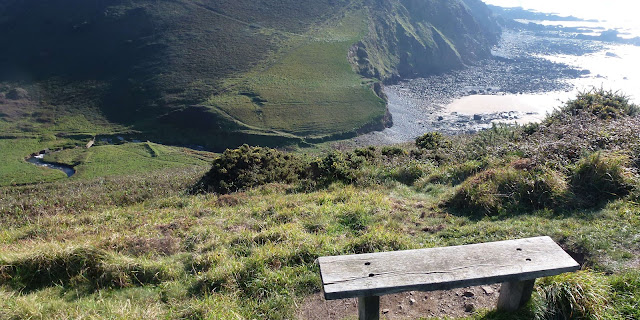
Sunday 29th September Crackington Haven to Boscastle

Feelling fully refreshed after a night at the Combe Barton Pub (which is highly recommended - very comfortable and excellent pub food) I set off on the next leg to Boscastle.  A little brighter at first and a fresh cooling wind. This view is across the beach at Crackington Haven.

Out to the headland - Cambeak....

...and the gently undulating coast path.

The view back.

A few minutes later and the initial  brighter sky had gone and the visibility wasn't so good - High Cliff is the dark cliff in the centre of the photo.

Through the landslip area above Strangles Beach.

 Looking back and down to Strangles Beach.

Upwards to the top of High Cliff - the highest cliff in Cornwall and as I peered towards the edge I was surprised to see these - either a rare breed of cattle or large wild goats?  The two in the middle were rutting and they joined heads with some force!

Looking back at High Cliff

On around Gull Rock - dramatic coastal scenery.

I took the optional higher route around Beeny Cliff and in front was the last headland to Penally Point.


But first you have to go down around the waterfall and back up the other side - I counted 189 steps!

This is the final stretch of gently undulating path to Penally Point - there is farm shop and cafe here if you need a break.  

A look back to the valley and little waterfall. By now the sky was brightening up again...

 ...as I descended into Boscastle...


...with the very pretty harbour.

This stretch was 8 miles long and I completed it in just under 3.5 hours. A bit easier than yesterday!

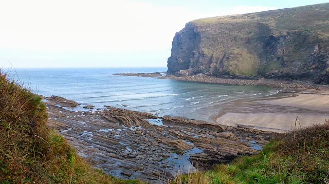
Saturday 28th September 2013 Bude to Crackington Haven

Well I didn't expect it would be nearly a year before I added to this blog!  Starting where I left off at Bude.  A shame it was a dull day day with lots of small showers - I think the sea sparkles if there is a little bit of sunshine.  This route is described in the handbook as "easy then strenuous"

I walked out by the sea lock heading out to Compass Point

These shots are all looking back to Bude.


An easy walk along the coast to Widemouth Bay...

...which given the weather was surprisingly busy...

...with people learning to surf....

...although I think they would be disappointed with the size of the waves!

Just ahead at the end of the beach is Black Rock.

It  is here that the coast changes and you go up on the higher cliffs and what makes it so difficult is that very soon...

...you go down again!  This is the hamlet of Millook.

You have to follow the road out of Millook for a while and the going here is gently undulating.

Then you come to Chipman Point where you repeat the whole process of going all the way down and then straight back up again.

And then again!

The footpath here takes you out to Castle Point and you follow this out to the end before turning sharply left to go...

...all the way down and up again - but this is the last one before Cracking Haven.


Up to the final headland and...

 Crackington Haven comes into view.


The Combe Barton and my resting place for the night.

11 miles in 4.5 hours and hard going!

Sunday 21st October 2012 - Welcombe Mouth to Bude

A beautiful day and the start of a new adventure - to walk the Cornish Coastal path.  Clear roads on a Sunday morning meant I got to Bude in just under an hour.  Next to find a taxi to take me to the start. Trev (of Trev's Taxis) told me I was lucky.  Taxis don't tend to run on a Sunday morning in Bude because the taxi drivers have been up all night on the busiest night of the week - but he had a pre-arranged booking and so he had his phone on.  He took me to the start to Welcombe Mouth where the surfers had been here for a while. I walked down to the car park - huge crashing waves and a very clear day. So off I went up the first of many steep climbs

Looking back down to the start...

...and straight down again to Marsland Mouth and this was to be the story of the walk - giant cliffs followed by deeply incised valleys to go up and then down again and they were all steep!


Down to the little bridge...

...which marks the border between Devon and Cornwall


...and up again...

...a flatter bit

Gull Rock below Marsland Cliff

Down to Litter Mouth

 Westcott Wattle
 

From the top of Henna Cliff I got my first view of the giant radio station...

 ...and then down again to St Morwenna's Well.

For the duration of the walk you could hear the power of the waves as they crashed down on the remote beaches.


Down to Tidna Shute


Higher Sharpnose Point


Greenaway Beach

The giant raidio dishes point in every direction - like huge ears on the landscape.  This is GCHQ Bude. What and who are they listening to is secret so the vast majority of us will never know! But we hope they are protecting us.

On the way down to Stanbury Beach two surfers stop to admire the view.

The climb up here was probably the longest and the worst!

But, first over the little bridge.


Another slightly flatter bit...

 ...before going down to Duckpool where there was a beach cafe open.  This was most welcome and I felt so much better after some coffee and cookies..


From here on the cliffs are lower and the going gets easier.


At last Bude is in view.

Crooklets Beach

Past the swimming competition...

...and back to the car park complete with the visiting fun fair.

This was a beautiful walk, mainly along the spectacular remote cornish coast and one of the hardest walks I have done -  absolutely brilliant.  Eleven and half miles in length but the constant steep up and downs take their toll.  The guide book describes this walk as 'severe' and 'probably the most arduous' on the whole of the South West Coastal Path.  Well that's good to know -  after this the rest should be easy!